GeoStream Statistics |
Learn more about Verizon Connect GeoBase.
Get information about the latest release
The active server page http://localhost/GeoStream/stats.aspx, provides useful statistics relating to your GeoStream server activity. Data, such as the number of tiles generated, or the number of geocodes performed, can be viewed in a table and on a graph.
To specify the data to display, you can build up a custom query. To do this, define or select the following:
- A From date
- A To date
- A Time interval in minutes
- A date range, such as Today or This month
- One or more graph types, such as Autocomplete Geocodes or Tiles Served. See the full list of available data types in the "Statistical Data Types" section below.
You can display the data in the table and on the selected graphs on the stats.aspx page, by clicking Update.
Alternatively, you can export the statistics in CSV or JSON format. To do this, click Export as CSV or Export as JSON.
You can use the active server page http://localhost/GeoStream/statsgraph.aspx to directly query GeoStream statistics and display them on a single graph. For example, the following URL requests a graph detailing the amount of tile data served by the GeoStream server from 24/03/2017 to 28/03/2017 and is shown in Figure 1:
http://http://localhost/GeoStream/statsgraph.aspx?fromdate=24/03/2017&todate=28/03/2017&interval=24&type=Tile%20Data%20Served&server=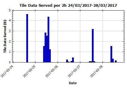
The query string is created using the following fields:
| Field | Purpose | Format/options |
|---|---|---|
| fromdate | The start date of the data period | mm/dd/yy |
| todate | The end date of the data period | mm/dd/yy |
| interval | The data interval time | One unit of interval is equal to 5 minutes. That is: 1 = 5 mins, 12 = 1 hour and so on. |
| type | The type of statistical data to return | See table below for options |
Beware of the following when using statsgraph.aspx:
|
The statistical data types available are detailed in the table below:
| Type | Statistics |
|---|---|
| Tile Data Served | The amount of raster tile data served by the Geostream server. Does not include data associated with non-tile requests. |
| Tiles Served | The number of raster map tiles of any type served. This is the sum of 'Tiles Served from WorkerPool' and 'Tiles Served from Cache Without Queuing'. |
| Mean Tile Serve Time (ms) | The mean time, in milliseconds, to serve raster map tiles of any type. |
| Tiles Served from Cache Without Queuing | The number of raster map tiles of any type that were served from the persistent tile cache without the request first entering the WorkerPool. |
| Mean Tile Serve Time (from Cache Without Queuing) (ms) | The mean time, in milliseconds, to serve raster map tiles of any type from the persistent tile cache without the request first entering the WorkerPool. |
| Tiles Served from WorkerPool | The number of raster map tiles of any type served after being queued in the WorkerPool for asynchronous completion. The WorkerPool is used when server requests cannot be completed synchronously (for example, when requesting tiles that are not available in memory or in the cache) or if completing the request immediately would unnecessarily consume synchronous threads. This is the sum of 'Tiles Served from Cache After Queuing', 'Tiles Served from Pre-Generated SuperTile After Queuing', and 'Tiles Served from New SuperTile After Queuing'. |
| Mean Tile Serve Time (from WorkerPool) (ms) | The mean time, in milliseconds, to serve raster map tiles after being queued in the WorkerPool. |
| Tiles Rejected | The number of map tile requests of any type that were rejected due to the WorkerPool exceeding its maximum permitted queue size. |
| Tiles Failed | The number of raster map tiles of any type that failed to be generated. These failures are typically the result of insufficient memory, but may also result from any other unexpected error or problem, such as traffic or WMS server connection failures, or the inability to locate a suitable GBFS map data source. |
| Tiles Cancelled | The number of map tile requests of any type that were cancelled because the client disconnected. This is usually because the map was panned or zoomed and the tile is no longer in view. |
| Bad Tile Requests | The number of map tile requests that were rejected due to incorrect tile parameters or because the client was not authenticated. |
| Tile Cache Read Errors | The number of errors that occurred while attempting to read tiles from the tile cache, excluding cache misses. Details of these errors are provided in the GeoStream's exceptions log. Read errors result in the tile being regenerated, as if it was not in the cache. |
| Tile Cache Write Errors | The number of errors that occurred while attempting to write tiles to the tile cache. Details of these errors are provided in the GeoStream's exceptions log. |
| Tiles Generated | The number of raster map tiles of any type generated by the Geostream server (including base map, satellite imagery, external (WMS or WMTS) and traffic tiles, among others). |
| Mean Tile Generation Time (ms) | The mean time taken, in milliseconds, to generate raster map tiles of all types. |
| Tiles Served from Cache After Queuing | The number of raster map tiles of any type that were served from the persistent tile cache, where the request was first queued in the WorkerPool. This happens when a tile doesn't exist in the cache at the time the request is received, but has been added to the cache while the request was awaiting a worker slot. |
| Mean Tile Serve Time (from Cache After Queuing) (ms) | The mean time required, in milliseconds, to serve raster map tiles from the persistent tile cache, where the request was first queued in the WorkerPool. |
| Tiles Served from Pre-Generated SuperTile After Queuing | The number of raster map tiles served from memory, where the associated SuperTile had already been generated following another tile request but was still held in memory pending rendering and persistent caching of the SubTiles. |
| Mean Tile Serve Time (Pre-Generated SuperTile After Queuing) (ms) | The mean time required, in milliseconds, to serve raster map tiles from a SuperTile that had already been generated and was still held in memory. |
| Tiles Served from New SuperTile After Queuing | The number of raster map tiles served from SuperTiles that had not already been generated. This is usually approximately the same as 'SuperTiles Rendered', as requests for SubTiles which aren't already available (or in the tile rendering pipeline) are what trigger the creation of new SuperTiles. |
| Mean Tile Serve Time (New SuperTile After Queuing) (ms) | The mean time, in milliseconds, taken to serve raster map tiles from SuperTiles that had not already been generated. |
| Tiles Served from Pre-Rendered SuperTile After Queuing | The number of raster map tiles served from memory, where the associated SuperTile had already been generated and the SubTile rendered following another SubTile request, but the requested SubTile was still held in memory pending persistent caching of all the SubTiles for that SuperTile. |
| Mean Tile Serve Time (Pre-Rendered SuperTile After Queuing) (ms) | The mean time required, in milliseconds, to serve raster map tiles that had already been rendered but were still held in memory. |
| Background Tasks Rejected | The number of background tasks (currently just SuperTileCache tasks) that were rejected due to the background WorkerPool exceeding its maximum permitted queue size. |
| SuperTiles Rendered | The number of raster SuperTiles rendered. SuperTiles are larger map images that are used to generate individual PNG format map tiles. These individual map tiles are stored in the persistent cache and can be drawn on a canvas to represent a small segment of a geographical map. |
| Mean SuperTile Render Time (ms) | The mean time, in milliseconds, needed to render raster SuperTiles. |
| Base Map SuperTiles Rendered | The number of raster base map (as opposed to satellite, traffic, or external WMS/WMTS) SuperTiles rendered. |
| Mean Base Map SuperTile Render Time (ms) | The mean time, in milliseconds, needed to render raster base map SuperTiles. |
| External SuperTiles Rendered | The number of external (WMS or WMTS, including satellite imagery) raster SuperTiles rendered, as opposed to traffic or base map raster SuperTiles. |
| Mean External (WMS or WMTS) SuperTile Render Time (ms) | The mean time, in milliseconds, required to render external (WMS or WMTS, including satellite imagery) raster SuperTiles, as opposed to traffic or base map raster SuperTiles. |
| Sat Tiles Served | The number of raster satellite imagery tiles served, as opposed to base map, other external (WMS or WMTS), traffic or other raster tiles. |
| Sat Tiles Generated | The number of raster satellite imagery tiles generated, as opposed to base map, other external (WMS or WMTS), traffic or other raster tiles. |
| External (WMS or WMTS) Tiles Served | The number of external (WMS or WMTS, including satellite imagery) raster tiles served, as opposed to satellite imagery, traffic or local (conventional map) raster tiles. |
| External (WMS or WMTS) Tiles Generated | The number of external (WMS or WMTS, including satellite imagery) raster tiles, as opposed to base map or traffic raster tiles, generated by the GeoStream server. |
| Culled Requests | The number of queued GeoStream server requests that were cancelled by the Geostream due to exceeding a time limit. |
| Upstream Sat SuperTiles | The number of upstream raster satellite SuperTile requests made. These SuperTiles are requested from an external source, not from the GeoStream server. |
| Upstream Fallback SuperTiles | The number of upstream raster satellite SuperTile requests made where the upstream server returned a fallback image to the GeoStream. Individual tile requests that use these fallback SuperTiles are counted in the 'Upstream Fallback Tiles Served' statistic. |
| Traffic SuperTiles Failed | The number of raster traffic map SuperTiles that failed to be generated. These failures are typically caused by failed connections to the traffic server, but they might also be caused by other unexpected problems, such as insufficient memory or being unable to locate a suitable GBFS map data source. |
| Geocodes | The number of forward geocoding operations performed using the GeoCoder class. Excludes operations executed by GeoCoder in connection with LocationSearch calls. |
| Mean Geocode Time (ms) | The mean time, in milliseconds, taken to perform a forward geocoding operation using the GeoCoder class. |
| Autocomplete Geocodes | The number of geocoding operations performed using the AutoCompleteGeocoder. Excludes operations executed by the ACGC in connection with LocationSearch calls. |
| Mean Autocomplete Geocode Time (ms) | The mean time, in milliseconds, taken to perform a geocoding operation using the AutoCompleteGeocoder. |
| Location Searches | The number of geocoding or search operations performed using the LocationSearch API. |
| Mean Location Search Time (ms) | The mean time, in milliseconds, taken to perform a geocoding or search operation using the LocationSearch API. |
| Rev Geocodes | The number of reverse geocoding operations (searches for physical street addresses that match supplied sets of latitude and longitude coordinates) performed. |
| Directions | The number of 'Directions' operations, such as 'GetDirection' or 'GetPoints', served to clients. |
| Optimizes | The number of route optimization operations, using an 'Optimize' RPC function, performed by the server. |
| Route Highlights | The number of route highlighting operations (that is, rendering a road-fitting trail above a map, representing the likely route taken between a series of stops using the 'GetRouteHighlight' RPC function) performed by the server. |
| Data Queries | The total number of data query operations, such as 'QueryPoints' or 'QueryLinks', served to clients. |
| JSON Requests Served | The number of JSON data requests successfully served to clients. |
| JSON Requests Rejected | The number of JSON requests that were rejected due to the WorkerPool queue already being full. |
| JSON Requests Failed | The number of JSON data requests that failed and were not served to clients due to an error or time out, but not including those that were cancelled by the client or because the client disconnected. |
| JSON Requests Cancelled | The number of JSON data requests that were cancelled before completion because the client disconnected or cancelled the request. |
| JSON Requests Timed Out | The number of JSON data requests that timed out before completion, not including requests that were cancelled. |
| WorkIntensive Tasks Queued | The total number of WorkIntensive tasks queued because all active slots are full. |
| WorkIntensive Time Spent In Queue (ms) | Cumulative time, in ms, spent in the queue across all queued WorkIntensive tasks. |
| Average WorkIntensive Utilization | The average utilization of active slots in the WorkIntensive worker pool. Displayed as a decimal between 0 and 1. |
| Average WorkIntensive Weighted Utilization | The average utilization of active slots in the WorkIntensive worker pool, with each sample raised to the power of 2 to give more significance to higher loads. Displayed as a decimal between 0 and 1. |
| WaitIntensive Tasks Queued | The number of WaitIntensive tasks queued because all active slots are full. |
| WaitIntensive Time Spent In Queue (ms) | Cumulative time, in ms, spent in the queue across all queued WaitIntensive tasks. |
| Average WaitIntensive Utilization | The average utilization of active slots in the WaitIntensive worker pool. Displayed as a decimal between 0 and 1. |
| Average WaitIntensive Weighted Utilization | The average utilization of active slots in the WaitIntensive worker pool, with each sample raised to the power of 2 to give more significance to higher loads. Displayed as a decimal between 0 and 1. |
| Fallback Tiles Served | The number of fallback map tiles that were served, due to failure to load appropriate satellite imagery for a satellite tile request. |
| Upstream Fallback Tiles Served | The number of map tiles that were served using fallback imagery provided by an upstream provider as part of a satellite tile request. These tiles appear with alternate satellite imagery to the type requested. |