GeoStream Satellite Imagery |
Learn more about Verizon Connect GeoBase.
Get information about the latest release
GeoStream can display map tiles with satellite imagery. This feature is simple to implement, and provides the user with a more detailed view, and a richer experience. The images below show the difference between standard view, and satellite view.
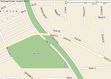
Without satellite imagery
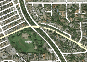
With satellite imagery
The satellite imagery is stored at Verizon Connect's imagery cache. When a request for satellite imagery is made, the Verizon Connect server sends the imagery to the GeoStream server. The GeoStream server will cache the imagery, and then render a new map tile with the satellite imagery for its client. The GeoStream server needs to be configured (see code sections below) to obtain the satellite imagery. When the GeoStream server receives a request from the client, the server will check its cache to see if the satellite imagery already exists – if it does exist, then the map tile is returned to the client. However if the satellite imagery does not exist, then the GeoStream server will need to request the imagery from the imagery cache at Verizon Connect. The data flow is shown in the diagram below.
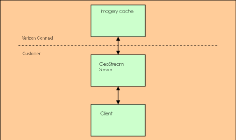
Data Flow
The configuration file Web.config should be modified to include your user name and your password to access the Verizon Connect imagery cache. This is done by adding SatelliteUser and SatellitePass keys, with appropriate values. The form that these two entries take is as follows:
<add key="SatelliteUser" value="name"/>
<add key="SatellitePass" value="password"/>
Only clients who have a valid Satellite Imagery contract will have a Username and Password for this service. If have a valid contract, but do not know your username and password, contact GeoBase support at gbsupport@verizonconnect.com. |
Also, you should ensure that the correct imagery cache is pointed to by using:
<add key="XYZSatelliteLayer" value="XYZSatellite" />
If the Web.config file contains the following obsolete key entry (typically found on line 15), it must be removed:
<add key="SatelliteHost" value="http://imagery1.telogis.com/ImageryCache/" />
To allow the client side of the application to request map tiles with satellite imagery:
- Switch your application from local mode to GeoStream mode (see tutorial Using GeoStream with .NET)
- set the "Satellite" property of the MapCtrl object
For example, switching to GeoStream mode:
static void Main()
{
  Repository.Default = new GeoStreamRepository("http://localhost/GeoStream");
  ...
  ...
}
Setting the "Satellite" property:
MapCtrl myMapCtrl = new MapCtrl();    // create a new map control object
myMapCtrl.Satellite = true;           // enable satellite imagery
Alternatively, in JavaScript:
new TileLayer ({
    ...,
    tileConfig: {satellite: true}
});