Web Map Services (WMS) |
Learn more about Verizon Connect GeoBase.
Get information about the latest release
The Web Map Service (WMS) is a standard that defines a simple HTTP interface for requesting data-centric map images. The interface also permits the transparency level of the returned image to be set allowing the image to be combined neatly with the GeoStream map control.
There are hundreds of web map services and thousands of WMS layers available to combine with your GeoStream map control. For example, you can add weather data (cloud cover, precipitation, land temperature, and so on), historical seismic activity, ocean depths (bathymetry), geological data, population statistics, to name but a few. When combined with a WMS layer, the GeoStream map control provides a richer environment and experience for the user due to the data-centric nature of the WMS layer, and the power and flexibility of the GeoStream map control.
Layers can be added with transparency, and placed either above streets (ideal for weather-type data), or placed in-between the map and the streets (ideal for satellite imagery). Below are a few examples of WMS layers combined with the GeoStream map control.
For a tutorial on how to combine WMS layers and the GeoStream map control, see the JavaScript tutorial Displaying WMS Layers.
For details on how to configure the GeoStream server that provides WMS layers, see Configuring the server.
For more information about WMS layers and providers, please see the WMS Links section below.
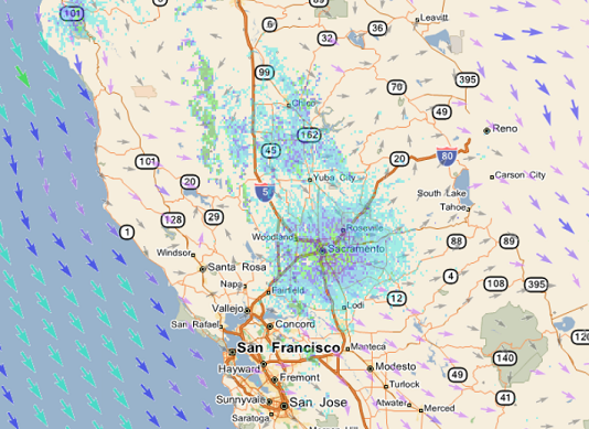
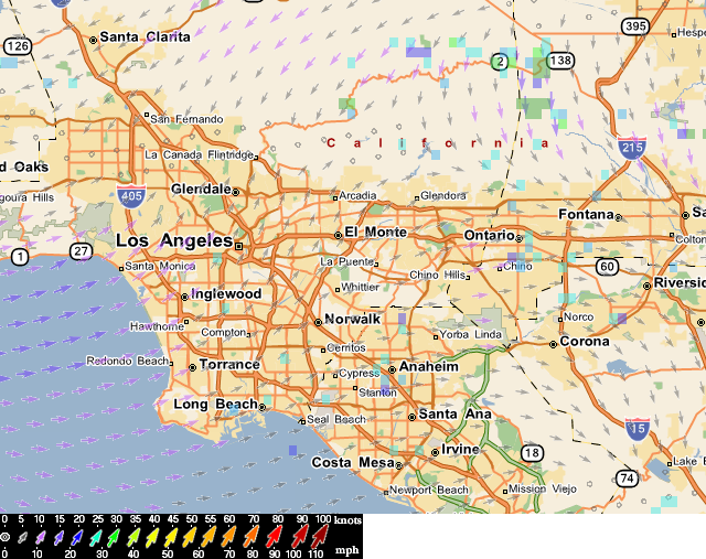
The image below shows a GeoStream map control combined with a near real-time weather layer showing wind direction and strength. Notice the legend that is also provided with this layer.
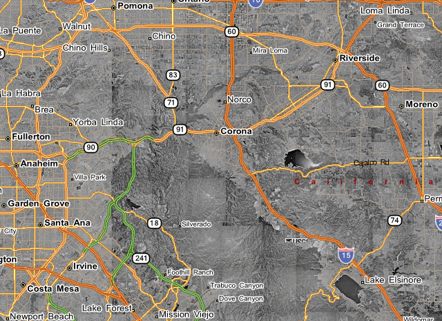
The following image shows Microsoft's TerrasServer Map Server's DOQ layer. The WMS layer has been set up with the GeoStream map control as a satellite layer so streets can be seen above the layer.
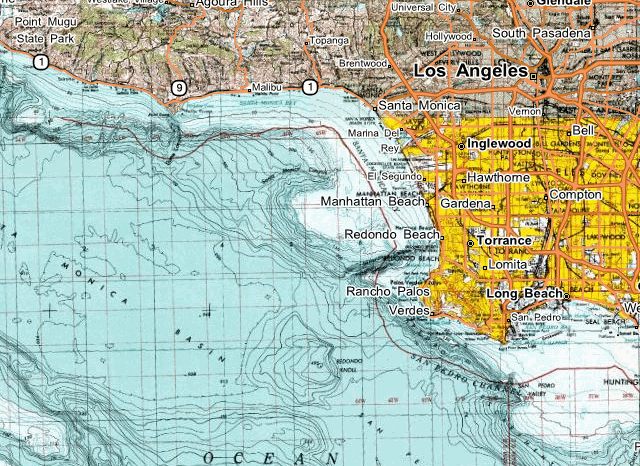
Another Microsoft TerraServer map server image, layer name DRG, provides a topographical element to the GeoStream map control.
The following links provide further links to a number of WMS providers and layers.
- http://www.mapmatters.org/ - provides a WMS directory and testing service
- http://nowcoast.noaa.gov/ - an extensive WMS site offering NOAA's real-time observations and forecasts
- http://geopole.org/about - search for public map services